

Maximising Data Coverage: Enhancing Terrestrial Laser Scanning with Drone Images and Measurements for Comprehensive Roof Analysis
- Feb 15, 2025
- 3 min read
In today's fast-paced world of architecture and surveying, blending innovative technologies can transform how professionals collect and analyze site data. One standout combination is the use of drone imagery alongside terrestrial laser scanning (TLS), especially for roof analysis. This article highlights the numerous benefits of using these technologies together, resulting in improved data coverage and accuracy that can elevate industry standards.

Understanding Terrestrial Laser Scanning
Terrestrial laser scanning is a modern 3D measurement technique that emits laser beams to gather accurate dimensions and geometries of structures. TLS or HDS creates detailed point cloud data, effectively forming a 3D representation of the scanned area. This level of detail is crucial for assessing structural integrity, planning renovations, or conducting routine inspections.
Nevertheless, TLS does have limitations. It can struggle to capture data in complex or obstructed spaces, particularly on roofs with no access and steep angles or intricate designs. That's where drone imagery comes in, filling critical gaps in data collection.
The Role of Drone Images and Measurements
Drone imagery uses technology to provide high-resolution measurements from angles that ground-based tools cannot reach. Drones can survey extensive areas quickly, offering perspectives that complement the accurate measurements obtained from terrestrial laser scanning.
The Synergy of Drones and HDS
Combining drone images and measurements with terrestrial laser scanning creates a powerful solution for thorough roof analysis. This dual approach significantly boosts data accuracy and coverage, tackling the limitations often found in traditional methods.
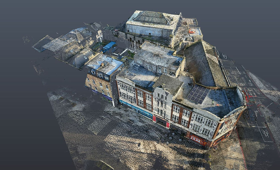
Comprehensive Data Collection
When drones and HDS are used together, they provide a complete view of roof structures. Drones can capture areas that may be unsafe or inaccessible, ensuring no detail is overlooked. For example, HDS may miss intricate roof designs or features located in hard-to-reach corners, while drones can easily document those from a bird's-eye view.
Additionally, using both types of data equips professionals with a more comprehensive understanding. For instance, while HDS gives exact vertical measurements, drones allow an overview of the roof's condition, making it easier to visualize its design and health.
Data Completeness and Quality
In data collection, discrepancies can arise from various environmental factors or technology constraints. However, enhancing HDS data with drone images leads to survey completeness. The aerial perspective offers insights into roof configurations, capturing details that HDS alone might miss.
Cross-referencing drone and HDS data can also enhance precision. This accuracy allows professionals to make better-informed decisions regarding renovations or structural assessments—significantly impacting the success of proposed solutions.

A New Era in Roof Analysis
The combination of drone imagery and terrestrial laser scanning offers transformative advantages for comprehensive roof analysis. This powerful partnership ensures complete data coverage, enhances problem detection, improves efficiency, and raises the overall quality of information gathered.
As technology evolves, the use of drones in surveying is likely to redefine traditional practices. Architects, builders, and inspectors can greatly benefit from this innovative approach, ensuring access to critical data for informed decision-making.
Leveraging both drone images and terrestrial laser scanning provides a deeper and more nuanced understanding of roof structures. Embracing these advancements not only paves the way for smarter building management and maintenance but also improves safety, saves costs, and optimises resource allocation in future projects.


